junho, 2019

Detalhes do Evento
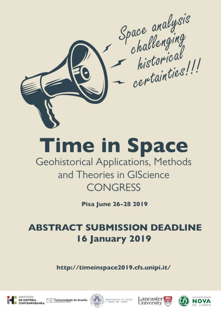
Congresso internacional que tem como objectivo analisar os novos desafios das análises SIG e da representação de dados históricos. Time in Space Geohistorical Applications, Methods and Theories
Ver mais
Detalhes do Evento
Congresso internacional que tem como objectivo analisar os novos desafios das análises SIG e da representação de dados históricos.
Time in Space
Geohistorical Applications, Methods and Theories in GIScience
This event is organised by the Universtià di Pisa, Universidade de Brasilia, Universidade NOVA de Lisboa and the University of Lancaster is open to researchers interested in the field of GIS application in the humanities. Between June 26th to 28th 2019 we will discuss and examine new ways and methods to represent and analyse time in the GISciences. Scholars from any discipline are invited to join us to share their experiences and case studies with a wide multidisciplinary community of researchers engaged in the main topics of the conference. Speakers should submit an abstract to the scientific committee for evaluation. As the official language of the conference is English, submission and presentation should be of the same language. Conference proceedings will be published as a special volume by spring 2020.
Some of the most significant obstacles in GIScience are the description, explanation and visualization of time. Cartographic representation of transformation, evolution and historical changes have always been a challenging and stimulating task for cartographers, researchers and scientists.
However, in the last three decades, revolutionary possibilities have been introduced by innovative digital tools that have offered to a large group of scholars – from a vast disciplinary range – the opportunity to explore new empirical solutions and applications for the spatial analysis and cartographic representation of time. Although technological advances have transformed the way we think, talk, and the tools we use, there has been a lack of critical and epistemological debate on the techniques, methods and theories for the representation of time within the GISciences.
We feel that there is a need for an interdisciplinary exchange concerning the main issues related to GIS applications in the study of historical processes.
Our aim is to join the scattered experiences conducted on multiple scientific fields in a collective dialogue. The objective is to share ideas and insights amongst researchers involved in the analysis and representation of changes by means of new digital cartographic technologies. It is by means of exchange that we aim to promote a wider awareness of the significant role and impact that these issues have for us and our research.
Programme:
26/06/2019 – Wednesday
08:30-09:00 | Registration
09:00-09:15 | Welcome, Department Director
09:15-10:15 – Keynote speech | Ian Gregory (Lancaster University, U.K.)
10:15-11:30 – Session 1
Reconceiving Space on Eighteenth Century Roads | Katherine McDonough, Turing Institute
Modelling historical accessibilities based on digitised historical networks | Raphaël Fuhrer, ETH Zürich
Mapping Sculpture in the Liminal Spaces of Early Modern Italy | Catherine Walsh, University of Montevallo
Transhumance space in historical transformations: processing textual and cartographic historical data of Grosseto district into a GIS framework | Michele de Silva; Cristoferi Davide; Giovanna Pizziolo; Mara Visonà; Andrea Zagli, Università degli Studi di Firenze
11:30-11:45 | Refreshments
11:45-13:00 – Session 2
Mapping time, mapping space: detecting and reconstructing the Madaba Mosaic Map s cultural and physical landscape through innovative technologies | Margherita Azzari; Carmelo Pappalardo; Anna Lena, Università degli Studi di Firenze
The Historical Atlas of Limousin: questions and methods for a contributory geo-historical data system | Juliette Morel; Anne Massoni; Rémi Crouzevialle, Université de Limoges
Quantifying the sound. The space of bells in medieval monasteries estates | Stefano Bertoldi, Università degli Studi di Siena
Medieval Time in Space. The Use of GIS for the Diachronic Study of the County of Barcelona (9th to 12th c.) | Maria Soler-Sala, University of Barcelona
13:00-14:30 | Lunch
14:30-15:45 – Session 3
Tor Marancia: digital tools for enjoyment and valorisation of a common | LuisaSpagnoli ; Arturo Gallia, Consiglio Nazionale delle Ricerche-Istituto di Storia dell’Europa Mediterranea
The virtual reconstruction of disappeared landscapes: to make the invisible visible | Pauline Deguy ; Margherita Azzari, Università degli Studi di Firenze
Space and Time representation of a Copper Age funerary context: the Poggio di Spaccasasso (Grosseto, Italy) case study | Giovanna Pizziolo; Nicoletta Volante; Matteo Faraoni; Francesco Savarino; Gaia Mustone, Università degli Studi di Siena
15:45-17:00 – Session 4
Archaeology and regional planning in Veneto Region: the case of the Piano Paesaggistico Regionale – PPR | Alice Vacilotto; Alessandra Depieri; Chiara D’Incà, Università degli Studi di Padova
As it was, as it were: the role and potentiality of GIS in preserving and analysing ancient Venetian maps. A proposal | Arianna Lorenzon, Ca’ Foscari University
Marin Sanudo’s itinerary in mainland Venice: HGIS applied to a travel journal of the late Fifteenth Century | Alessandra Ferrighi, Università Iuav di Venezia
Spatial analysis to unravel the Greek-Roman settlement dynamics. An example from a coastal area landscape (Basilicata, southern Italy) | Maria Danese; Paola Di Leo; Giuseppe Corrado; Dario Gioia; Marcello Schiattarella, CNR-IMAA
17:00-17:15 | Refreshments
17:15-18:15 – Session 5
Abandoning children in Lisbon during the 19th century: continuities and changes | Joana Vieira Paulino, IHC – NOVA FCSH
Time and Space in the South Atlantic in times of the “Iberian Union”. The database “Brasilhis, Personal Networks and Circulation in Brazil during the Hispanic Monarchy (1580-1640) | José Manuel Santos, University of Salamanca
A Spatial Humanities approach to the study of hotel industry in Lisbon in the end of the nineteenth century | Daniel Alves, IHC – NOVA FCSH
18:30-19:15 – Keynote speech | Diego Jiménez-Badillo (INAH, Museo del Templo Mayor, MX)
27/06/2019 – Thursday
09:00-10:15 – Session 6
Always keep your feet dry. The importance of GIScience for facing present-day challenges through reconstructing (pre)historical-adaptive strategies | Rowin J. van Lanen; Menne C. Kosian, Cultural Heritage Agency of the Netherlands
Digital narrations: the historical gis for the management of territory and the environmental risk mitigation | Sara Carallo, Università degli Studi di Roma Tre
Natural assets and cultural heritage: Conflict management through GIScience | Armando Montanari; Barbara Staniscia, Sapienza Università di Roma
Strumenti GIS e archeologia: il caso di Baone | Maickol Quarena
10:15-11:30 – Session 7
The palimpsestical road networks of the colonial Route of the Silver of Potosí, through the prism of historical cartography (XVIII-XX centuries) | Thibault Saintenoy; Maria Florencia Malvarez; Laurent Costa, Institute of Heritage sciences
Applying GIS to analyze the economy of Portuguese Amazon during the 18th century | João Ramalho, Universidade Federal do Pará
Historical narrative with maps: GIS and indigenous people in the Amazon in the 18th century | Manoel Domingos Farias Rendeiro Neto, University of California, Davis
11:30-11:45
Refreshments
11:45-13:00 – Session 8
Changes in the administrative boundaries of Tuscany from 1750 to nowadays: a historical geodatabase | Anna Guarducci; Camillo Berti; Massimiliano Grava, Università di Siena
Globsearoutes (gsr) an historical geodatabase | Guido Abbattista; Andrea Favretto, Università di Trieste
AgriHistory Gis. High farming, latifundium and sharecropping in comparison. A geo-spatial study on the Agrarian Cadastre of 1929 between Lombardy, Tuscany and Puglia | Giacomo Zanibelli; Vito Ricci, Universidad Carlos III de Madrid
Pauliceia 2.0: A Spatiotemporal Platform for Digital Humanities | Luis Ferla; Karine Reis Ferreira; Cristiane Regina Miyasaka; Fernando Atique; Daniela Musa; Nandamudi Vijaykumar; Ana Barbour; Carlos Alberto Noronha; Orlando Guarnier; Rodrigo Mariano; Janaina Yamamoto Santos; Priscila Meireles; Wania Mazzarello; Cintia Rodrigues de Almeida; Denis Taveira de Lima; Ester Dantas Nunes; Gabriel Sansigolo; Luanna Nascimento; Monaliza Caetano dos Santos; Vitória Martins Fontes da Silva; Eduardo Goiabeira, Universidade Federal do Estado de São Paulo
13:00-14:30 | Lunch
14:30-15:45 – Session 9
Geoprocessing applied to rural modules: “From the Freguesia do Caminho Novo” to “Santo Antônio do Paraibuna”, XVIII-XIX centuries | Rafael M. O. Laguardia, Universidade de Juiz de Fora – UFJF
Marseille during the French Revolution, 1789-1794. Historical mapping test from GIS | Angelo Odore; Davide Gherdevich; Daniele Di Bartolomeo, Università di Teramo
Brokering Distance in a Fragmented Empire: Legal Proxies in 18th-Century Colonial Brazil | Leonardo Barleta, Stanford University
15:45-17:00 – Session 10
Heatmap and geostatistic analysis: evaluation of the concentration of radon level in Lombardia | Filippo Gagliano, IS Lotto
Geographical perspectives of the 1912 Census. A quest for founding a Romanian National HGIS | Cezar Buterez; Theodor Cepraga; Andreea Popa; Marius-Andrei R Duc; A. Iulian Dochi; Oana Candit, Faculty of Geography, University of Bucharest
Re-imagining places trough old maps and pictures: the Jewish ghetto of Trieste | Giovanni Mauro; Cristina Fenu, Università di Trieste
Spatial analysis of the Muslim population of Ufa based on the “religious census” of the NKVD in 1923 | Aislu Yunusova; Yulay Absalyamov, Russian Society of Historians and Archivists. Bashkir Branch
17:00-17:15 | Refreshments
17:15-18:30 – Session 11
Lines, when to straighten them? An inquiry in Historical Geography and Cartography | Vinicius Maluly, École des Hautes Études en Sciences Sociales
Too Good to Be True. Geospatial Data Models and the Old Reich | Luca Scholz, Stanford University
Narrative Maps in History | Tiago Gil, Universidade de Brasília
Map this! Mapping without cartography and GISscience | Daniele Ietri, Libera Università di Bolzano
19:00 | Dinner (Poldino’s restaurant)
28/06/2019 – Friday
09:00-10:15 – Session 12
Recognition of Colonial Urban Structure in Brazil with Satellite Analysis and GIS Methods | Amanda do Couto, Universidade de Brasília
Re-mapping the first capital of colonial Brazil: Colonial representations, urban dynamics and individual mobility in Salvador da Bahia (1549-1700) | Irene Maria Vicente Martin, European University Institute
Mapping the ancient urban density, turning a map in dataset | Davide Pavia, Sapienza Università di Roma
The historical cartography and the Gis in the study of cities: the case of L’Aquila | Paola Tagliente; Daniele Di Bartolomeo, Università di Teramo
10:15-11:30 – Session 13
Mapping the past: new perspectives for the georeferencing process | Arianna Traviglia; Irene Sarcinelli, Università Ca’ Foscari di Venezia
From photos to GIS: comparing geo-referenced and vectorised historical ground photos and cartographies for an assessment of rural landscape changes. The case study of the Aveto Valley (Liguria, Italy) | Nicola Gabellieri; Carlo Alberto Gemignani, Università di Trento
Creating collections of entities with temporally attributed geometries in nodegoat | Pim van Bree; Geert Kessels, LAB1100
Time in Place for Historical Gazetteers | Karl Grossner, University of Pittsburgh
11:30-11:45 | Refreshments
11:45-13:00 – Session 14
Virgohamna and those expeditions to the Arctic | Gianluca Casagrande, GREAL – European University of Rome
Computational approaches to explore historical geographies: New Spain in the 16th century | Patricia Murrieta-Flores; Raquel Liceras-Garrido; Katherine Bellamy; Bruno Martins; Mariana Favila-Vázquez; Diego Jimenez-Badillo; Jacinto Estima; Ian Gregory, Digital Humanities Hub – Department of History, Lancaster University
Deconstructing voids, recreating colonial settlements: the Northern Brazilian “Sertões” and their territories | Esdras Arraes, Universidade de São Paulo – USP
Challenges in Combining Historical and Cartographical Sources in a Historical GIS Project | Peter Paul Marckhgott-Sanabria; Antonia Dückelmann; Anna Piechl; Peter Andorfer; Matthias Schlögl, ACDH-OEAW
13:00-14:30 | Lunch
14:30-15:45 – Session 15
PAST IN USE. A Methodology for the recognition of identity values in historical cultural landscapes | Margherita Azzari; Camillo Berti; Paola Zamperlin, Università degli Studi di Firenze
The documentary heritage of the ex Institute of Geography of the University of Rome Sapienza: educational applications in GIS environment | Sandra Leonardi; Monica De Filpo; Epifania Grippo, Sapienza Università di Roma
Where I live? GIScience and historical sources for the knowledge of your neighbourhood: a teaching experience | Arturo Gallia, Università Roma Tre
The Observatory of Conflict Prevention | Adriana Erthal Abdenur; Robert Muggah; Giovanna Kuele; Carlos Coutinho, Igarapé Institute
15:45-17:00 – Session 16
Mapping the Middle Ages. From primary, lacunous, unstandardized, diverse sources to dynamic maps | Enrica Salvatori ; Paolo Mogorovich, Università di Pisa
Reconstructing a historical place: The digital map of the Western Hills of Athens | Stamatina Lampraki; Leda Costaki; Anna Maria Theocharaki, Dipylon Society for the Study of Ancient Topography, Athens, Greece
Assessing and representing land use/land cover changes along historical walls and rivers in Padova | Guglielmo Pristeri; Francesca Peroni; Salvatore Pappalardo; Daniele Codato; Massimo De Marchi, Università di Padova
Hidden waters. A methodology for the census of covered streams in urban areas | Margherita Azzari; Camillo Berti; Paola Zamperlin, Università degli Studi di Firenze
17:00-17:15 | Refreshments
17:15-18:30 – Session 17
Tracing Places and Dates in an Early Modern context | Arno Bosse, University of Oxford
Venetian Estimi as a source for landscape change in Modern period. A critical analysis of an historical GIS | Viviana Ferrario, Università Iuav di Venezia
Dynamic map of external Russian borders (1462-2018) | Alexey Frolov, Institute of World History, Russian Academy of Sciences
Imperial Agents or Fomenters of Social Capital: Locating the Impact of Protestant Missionaries in Modern Turkey | Emre Amasyali, McGill University
18:30-19:30 – Session 18
Historical landscape of the Eastern Euganen Hills | Luca Caloi, Università di Padova
Land use and cover reconstruction via GIS techniques with heterogeneous sources of different periods. Change of a part of Pontine Region during two hundred years | Diego Gallinelli, Università degli studi Roma Tre
The Changing Landscapes in the Pisa South Picenum Survey Project II | Simonetta Menchelli; Eleonora Iacopini, Università di Pisa
Presentation Software
27/06/2019 – Thursday (Sala Seminterrata)
11:00-12:00 Paolo Cavallini (Faunalia)
12:00-13:00 Geert Kessels (Nodegoat)
For any questions about the conference, please direct emails to: tis2019@cfs.unipi.it
🔗 Call for papers
🔗 Scientific Committee
🔗 Organising Committee
Best Congress Paper Award
The objective of the competition is to promote and disseminate excellence and to stimulate the willingness of congress participants to submit and present high quality talks. This award aims to celebrate inspiring and effective presentations and engage participants even further and encourage them to put as much effort as possible into raising the the standard of speeches. Presentations will be judged according to the following criteria:
clarity of expression and quality of presentation.
Originality: The paper is innovative and constructively confront with new or complex problems of GIS applications in the humanities.
Significance and relevance: The paper makes an important contribution to the current debate and the advancement of knowledge in GIScience.
Methodological rigour and excellence: The paper uses robust and appropriate methods to address the research question.
Potential impact: The paper has the potential to alter prevailing theory or practice in GISscience.
The winner will be elected by the conference participants. Contributions of the plenary and closing plenary session as well as invited talks are not eligible.
Tempo
26 (Quarta-feira) 8:30 am - 28 (Sexta-feira) 7:30 pm
Localização
Residence Le Benedettine
Organizador
Instituto de História Contemporânea — Faculdade de Ciências Sociais e Humanas da Universidade NOVA de Lisboa, Universtià di Pisa, Universidade de Brasilia e University of Lancaster

